News
Fellfoot voices: Uncovering the past at Carlatton cairn
Uncovering the past at Carlatton cairn
Fellfoot voices blog by Jodie Hannis from DigVentures
During the last week of June and into the beginning of July, a small army of people assembled to investigate a mysterious monument in the shadow of Cumrew fell.
Following a series of survey activities in April of this year (read our last blog post here), we determined that Carlatton cairn would be an excellent candidate for a small-scale archaeological excavation. Although the monument is listed in the Cumbria Historic Environment Record (HER), a question mark hangs over the site; is this simply a medieval field clearance cairn or does it perhaps have prehistoric origins?
It’s largely impossible to date a big pile of stones – and what a big pile it is. At nearly 40 metres in diameter, we would have to put in some serious graft to get through the cairn and underneath it in order to look for evidence that would help us suggest a date for the cairn’s construction. Thankfully, 25 brave souls volunteered to help us find out.
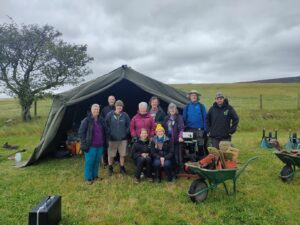
Image: Our merry crew on one of our dig days. L to R: Joan, Andrew, David, Maralyn, Bob, Joy, Malcolm and Ben, with Jodie and Kim perched precariously on a tool box in the front.
Although the mission was fairly simple, tackling the cairn required careful thought. Knowing that we only had nine days of digging, we had to strategise carefully to determine the most efficient way of answering our questions, without having our heroic volunteers spending all day hauling rocks. We laid out a long, thin trench, only two metres wide but nineteen metres long, giving us a nice slice from the centre point of the cairn all the way out to its perimeter on the north side of the monument. We wanted to catch a glimpse of as many different features of the cairn as possible in the hope that we’d catch a representative view of what’s going on underneath all that stone.
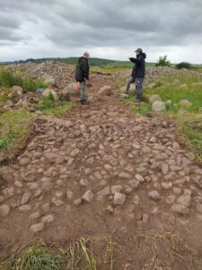
Image: A lot of archaeology involves standing, looking and pointing while trying to look thoughtful
Then we got to work. We taught volunteers how to methodically and scientifically excavate using tools such as mattocks, shovels and, of course, the trusty archaeological trowel. We went down layer by layer, balancing speed and care. Archaeological excavation is based on understanding the processes and formation of stratigraphy – that events and activities ‘layer’ up through time, with the most recent layers found at the top of the trench and the oldest layers sitting at the bottom. As we dig, we peel a layer off at a time until we reach the natural geological layers at the very bottom of our trench; as we go down, we go back in time. It can be complicated work but our volunteers picked it up with gusto, quickly getting their eyes in to the subtle changes in soil colour and texture that we make ourselves sensitive to. It was wonderful to see their skills and confidence increase and it always astounds me how receptive and enthusiastic people are to me talking avidly about very subtle differences in soil colour and composition.
This bring us back to our main question; how old is a pile of stones? Understanding the stratigraphy of a site is our main way of understanding the relative dating of a site i.e. what is older and what is more recent. When it comes to dating something to a particular time period, we keep our fingers crossed for artefacts that can be more accurately dated. A prehistoric site will have far fewer finds than, say, a Roman site (they were messy and left loads of stuff behind) and I found myself often telling people not to get their hopes too high for artefacts. But no, once again, the volunteers rose to the occasion and found a small assemblage of finds which are incredibly promising.
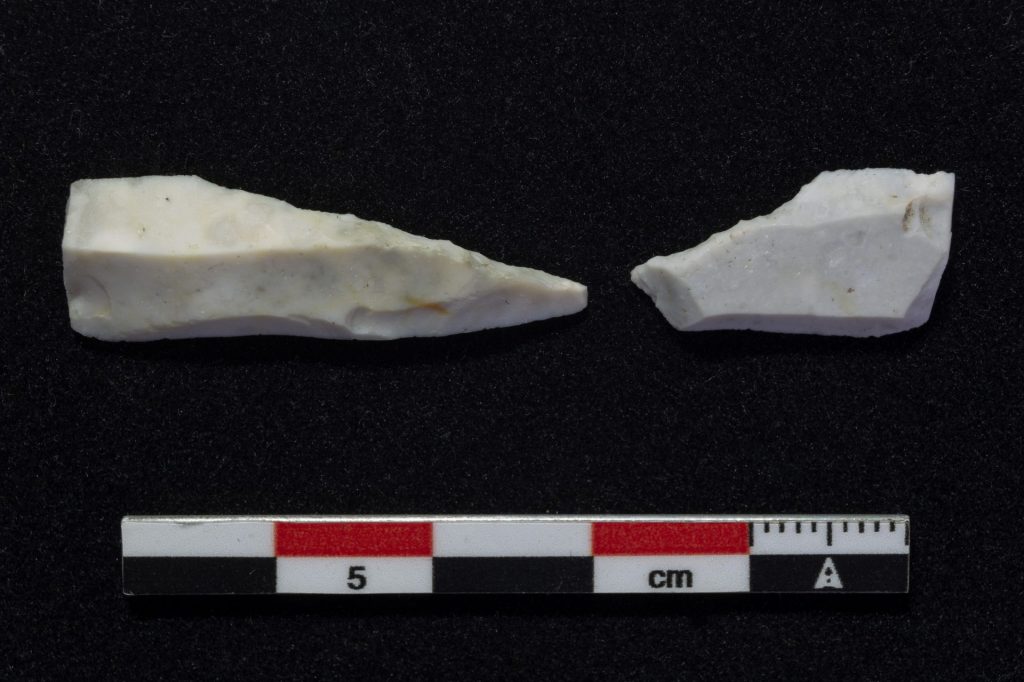
Perhaps the bread and butter or prehistoric sites; more rocks. Specifically, pieces of worked flint which are really compelling evidence than humans were here, making and using stone tools before the technology of metal working came into the area. Flint is not naturally occurring in the area so this is a really positive indication that prehistoric people were indeed here.
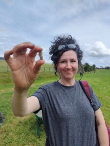
Image: Colette and her eagle eyes found the first of several fragments of worked flint
From the above picture you can see that you need to be paying very careful attention spot these little beauties. I can’t say we found beautifully crafted stone tools; rather, our flakes look more like the ‘waste’ flakes that are produced as someone carefully chips away at a flint core. Evidence, perhaps, that someone once sat here amongst the stones, glancing up as they worked at the cairn at Cardunneth Pike above them, before moving forward on their journey. It’s an evocative image that even the smallest of artefacts can conjure to life.
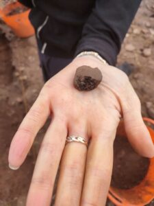
Perhaps our most exciting find, which will again provide vital dating evidence, was this small, unremarkable-looking bit of pottery (modelled by Janet below).
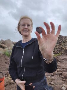
Although it looks like a half-eaten dog biscuit you’d find down the back of the sofa, it’s actually prehistoric pottery – huzzah. We’ll be able to date this is a broad time period and again, shows that prehistoric people used this site. It could be part of a storage or cooking pot, or perhaps could even be a fragment of an urn that would have been buried holding cremated human remains, which is the most common way people dealt with their deceased in the Bronze Age. We may not be able to say something very detailed from such a small fragment but alongside our flint collection, we can be pretty confident that we are indeed looking a prehistoric monument. Result.
Did you notice that I said ‘monument’ rather than ‘cairn’? Rather quickly during the excavation, we started to question what we were looking at. Within our trench, we excavated around three large boulders which looked as though they might be in situ, i.e. in their original locations where they were placed. Again, careful excavation could confirm that this looked most likely. Looking outside our trench, we could see more boulders disappearing under the rest of the cairn in a suspiciously curvilinear fashion. So the question here is… how many stones sitting in a curvilinear fashion does it take to make a stone circle??
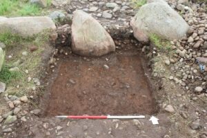
Image: Our three boulders tantalizing us with ideas of stone circles. Note the lovely straight edges of the trench and incredibly tidy trowelling that’s happened here – this makes me a very happy archaeologist
Our site director, Nat, gives us an insight as to what he thinks is going on:
“What we think is most likely is that we’re seeing multiple phases of occupation here at Carlatton cairn. These boulders, perhaps initially set as a stone circle or the outside perimeter of a smaller cairn, are subsequently covered up as people decide they want a bigger monument! So they expand it and create a stone bank around the outside, and likely people continue to add and take away stone from the cairn over the course of thousands of years.”
Tantalisingly, on the very last day, we just clipped the edge of a possible ditch, right on the very edge of one of our slots. Typical. It’s a longstanding joke in archaeology that you’ll find something good on the last day of the dig, just as you’ve run out of time and have to backfill everything. But we have to excavate carefully and not bite off more than we can chew; our job isn’t just digging but carefully recording everything as we go along. This included taking hundreds of photographs that can be knitted together using some fancy software to generate 3D models of the trench. The image below shows you a hint of the detail that is possible which such methods, and also hopefully captures the sheer scale of what the team did during just nine days on site (including one afternoon which got rained off).
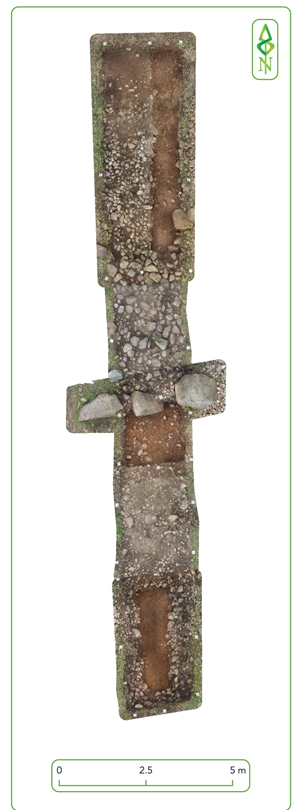
Image: Our ‘post-excavation’ model of the entire trench in ‘plan’ which is created by knitting together hundreds of photos that are taken from every possible angle
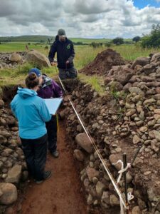
Image: Another tidy trench, with special attention paid to our straight section edges of the trench. Volunteers Caroline and Clare swiftly picked up the fine art of archaeological scale drawing, carefully recording the different layers – the stratigraphy – of the site,
as seen in profile
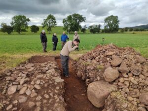
Image: Volunteer Mike takes hundreds of high definition photographs in order to create our 3D model of the trench. John Picken lurks in the back wielding our GPS, affectionately nicknamed ‘Beyonce’ (the GPS, not John)
What’s clear is that there’s lots more to explore at Carlatton cairn and I’m confident that the stones have lots more secrets to reveal. But this investigation, the first at this site, has already yielded so much and added significantly to our knowledge. This, of course, wouldn’t have been possible without the dedicated and hard-working group of volunteers who turned up in the wind, rain, and (very occasional) sun to put in the hard graft. We hope you all had a fabulous experience; I know I certainly did. Keep your eyes peeled for another blog post coming soon about the geophysical survey we conducted in the neighbouring field, how we were able to get students from Richard Rose Academy and William Howard School to help, and what’s next for the Uncovering the Past project. (And of course, the full archaeological report which I know you’ll all be dying to read in full.)
Jodie, Nat and Ben (the DigVentures crew)
Huge thanks go to the Mitchell family for their generosity and hospitality in allowing us to put a great big hole in their field.

