News
Fellfoot voices: Uncovering the past update
Uncovering the past update
Fellfoot voices: by Jodie Hannis from DigVentures
Welcome to your next update on our archaeological adventures as part of Fellfoot Forward’s Uncovering the Past projects. If you’ve not seen it yet, I highly recommend catching up on our last blog post which will get you up to speed on our community excavation at Carlatton Cairn and our thoughts on what we’ve found so far.
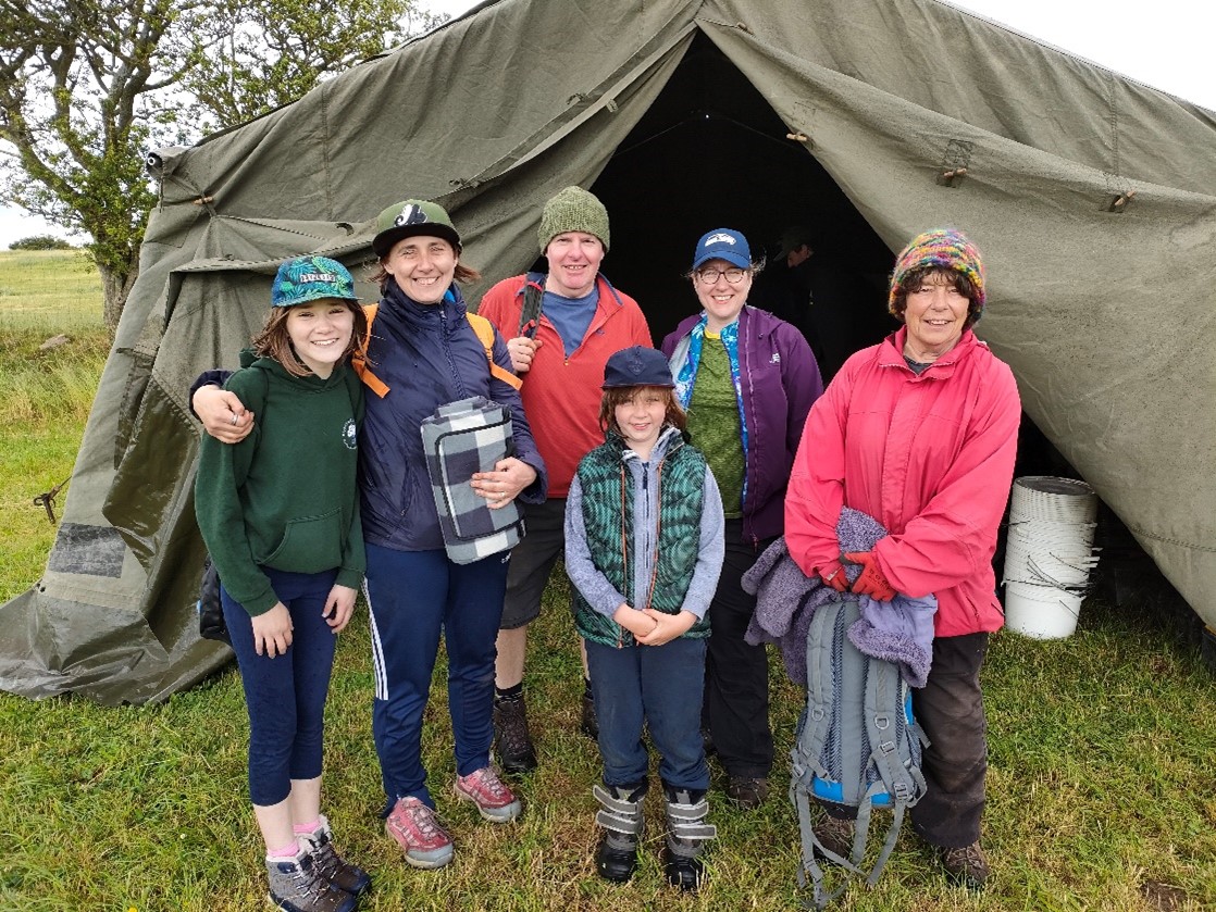
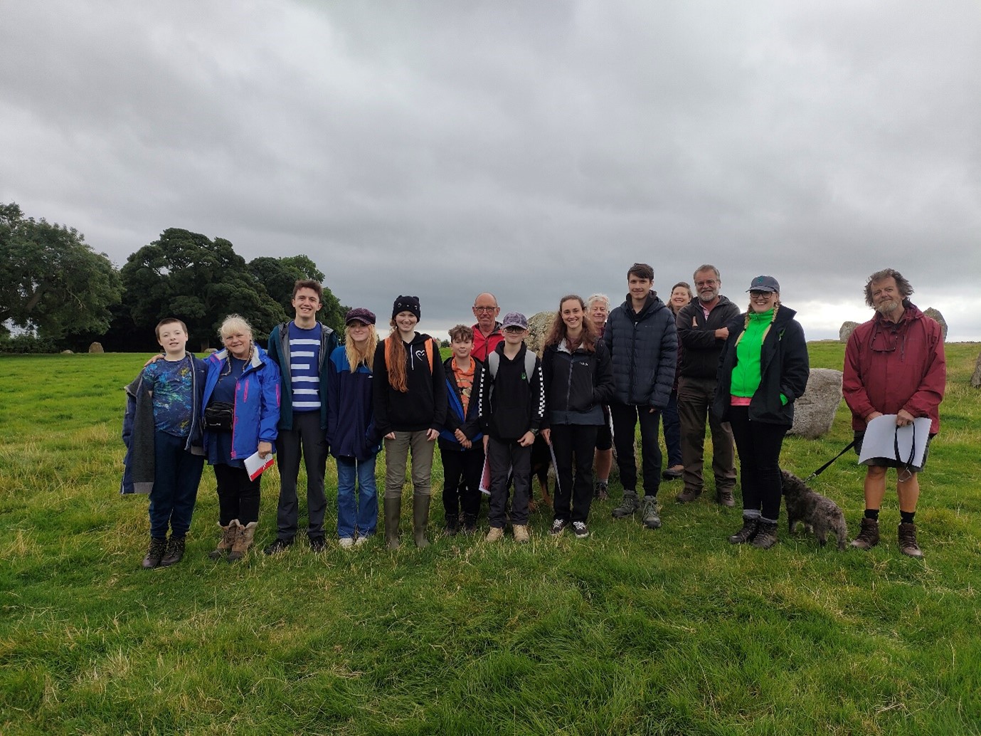
In this post, I want to share with you a very important aspect of this project, and some very exciting results from our expanded geophysical surveys at Long Meg, Grey Yauds and Carlatton cairn. We started to investigate these areas back in April and the results were so intriguing that we decided to extend our survey and come back for another sweep (see here for what we got up to in April). This time, thanks to the generosity of the Cumbria Community Foundation, we wanted to create opportunities for young people in Cumbria to come together, have some brilliant days out, and learn about archaeology. I’ll admit, I’m always on the look out for our next generation of archaeologists; as my knees give in and I slowly increase the prescription of my glasses, we need new, young bodies and brains to take up the mantle so I can take more breaks next to the kettle.
Age is no barrier to getting involved. In fact, children and young people tend to have keener eyes and more patience hunting for small artefacts in the soil.
The support of the CCF meant that we were able to extend our planned fieldwork at Carlatton Cairn and run sessions specifically for young people in the area to get their first taste of archaeology. We welcomed a combination of young people dragging their parents along so they could get stuck in with the rest of the volunteers and visits from school groups who dropped in for the day. After a thorough induction and health and safety talk (yawn!) we got stuck into the good stuff. Our young archaeologists learned the fine art of the trowel and soon they were busy cleaning back a section of the cairn. Their eagle eyes were employed in the classic game ‘Rock Or Not?’ as they scrutinised every inch of dirt and stone for those elusive flakes of worked prehistoric flint.
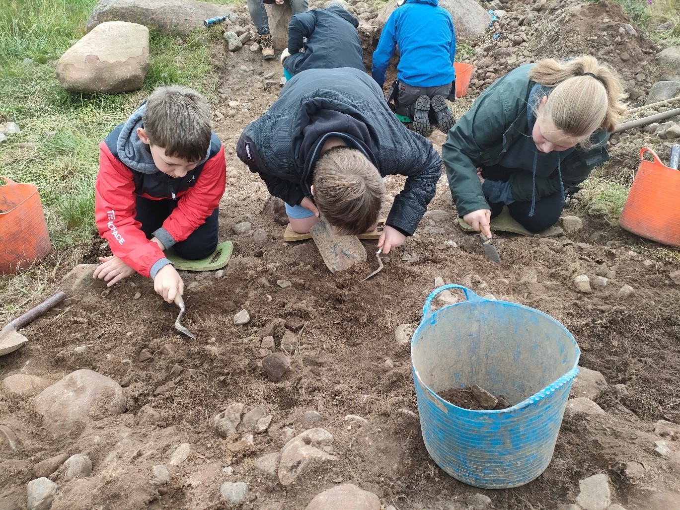
Students from Richard Rose Academy in Carlisle were not going to let any artefact escape unnoticed
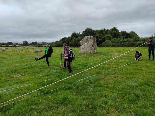
In addition to learning archaeological excavation, we ran geophysical survey workshops for the young people who joined us. Under the careful tuition of our geophysics expert Kim, they were guided through the science behind remote sensing methods and how to set out survey grids. Finally, Pythagoras comes in handy! We set them up and off they went, walking in strips along the survey grids, collecting valuable data in our hunt for the missing medieval church.
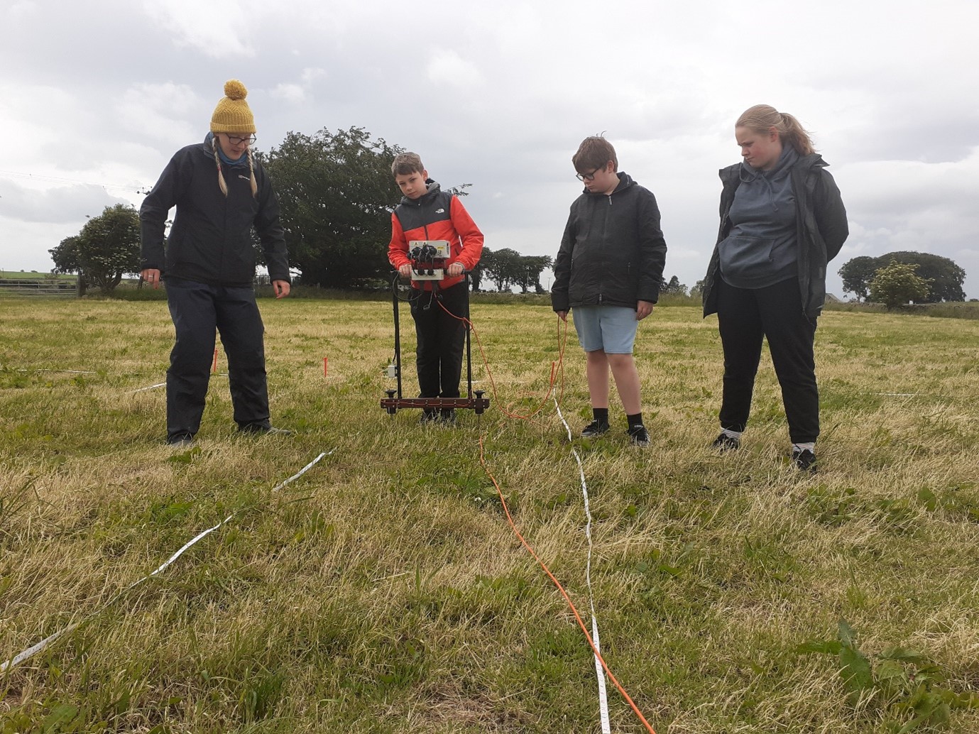
Our geophysicist Kim sets off our archaeologists-in-training using electrical resistivity to get a sneak peak of what’s going on underground
It was a delight to be joined by these bright and energetic young people, and I harbour a secret hope that we have captured the imagination of at least some of them and inspired them to seek out more archaeological experiences in the future. We’d certainly have them back! After a tough few years isolated from their friends and missing out on fun group activities, it seems more important than ever to create as many opportunities as we can for the young people in Cumbria to learn and thrive outdoors in our beautiful Eden Valley.
We worked them hard but not that hard. I’d suggest Henry might be hamming this one up a bit.
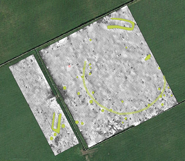
So… what did they find? Following a survey day we did earlier in the year with the volunteers from the Fellfoot Forward Landscape Partnership Scheme, we decided to do a chunk of magnetometry survey before getting the school kids collecting some earth resistance data in the same area. Let’s have a look at all the data we have been collecting this year and start to piece it together. We’ll start with the field right next to Carlatton Cairn, which we think is a possible likely spot for the missing medieval church of Carlatton. The magnetometer data looks like this:
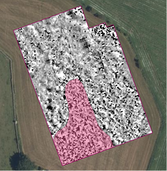
Nothing too striking stands out in terms of structures, however what does stand out is that the south-west part of the data contains lots of enhanced magnetism, which seems to spread out towards the centre of the field. This is interesting – it suggests that magnetically enhanced material has been spread / dumped / ploughed out into the field. This could relate to the ‘stone’ the farmer mentioned he kept finding in this field? Are we seeing an area of destruction in the south-west (maybe ruins of a former building) that has then consequently been ploughed into the topsoil of the field? Did we just miss finding the location of a former building, and it’s actually just to the south-west of our survey area? The rest of the anomalies just look geological – natural variations and undulations and small spreads of farming rubbish, small drains etc.
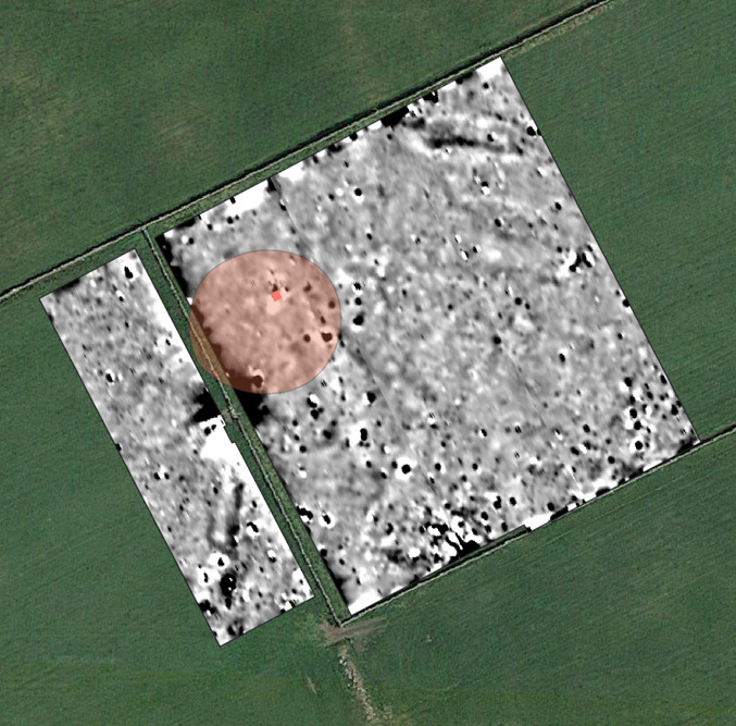
The Fellfoot volunteers earth resistance data is at the northern end of the field, with the school children’s right below it, and it looks like this:
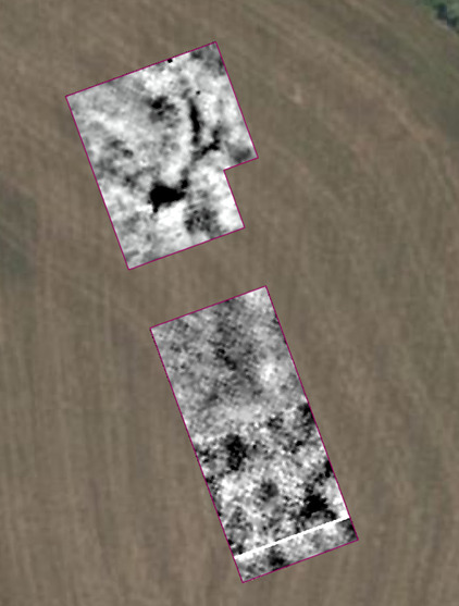
Earth resistance data for this area
The data gathered by the young people at the bottom is grainy because we did a 1m x 1m survey with them, so it’s low resolution data pixels, whereas the adults did 0.5m x 0.5m so more data per pixel.
These are some very strange anomalies indeed and do not correspond with anything in the magnetometer data really – which suggests they don’t have particularly magnetic properties and therefore could be geological. Apart from… can you spot it?
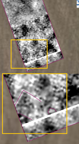
This rather gorgeous negative rectilinear enclosure! Is that a building you ask? Could be – low resistance could mean ditches or foundations where water is pooling up against them.
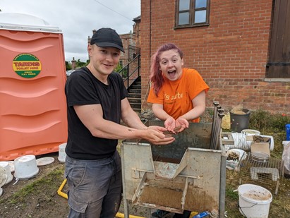
Bonus content: We recruited some Cardiff University students to help us process the environmental samples we took from our Carlatton Cairn dig. Here you can see Jess and Rufus up to their elbows in it, as they carefully separate precious environmental remains such as charcoal and burnt plant material which we’ll be able to send off for radio cardon dating. Archaeology really is a team sport.
Grey Yauds
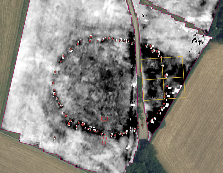
After a particularly disastrous wet earth resistance survey at Grey Yauds earlier this year, we returned to do a full magnetometer survey. The data looks like this:
The pink circle is the current scheduled area, with the pink square in the north of it being the current only visible standing stone of the original 88. What you want to look for is the magnetically enhanced dipolar anomalies (white with a black blob in the middle – I have illustrated these as green blobs), and it becomes apparent that we have a semi-circular alignment of these kinds of anomalies. The XY trace plot of the magnetic signals shows this up really nicely:
The XY trace is kind of like a heartbeat monitor. Pit-like and magnetic anomalies have specific traces, as do modern and very ferrous things. I have overlayed it on the data to help identify the archaeology a bit better.
The super spikey bits around the edges of the data are the metal fencing and gates, and the lower peaks and troughs I have picked out as they look like pit-like anomalies, aka maybe stone sockets. They kind of roughly align into a semi-circular patterning, which could be the stone circle! I might have picked out bits that aren’t necessarily sockets, so I will study them more closely and pick them out and hopefully they will align a bit better. And there are two odd rectangular enclosures which are likely archaeological. We also potentially have another semi-circular alignment of stone sockets below the south-western rectangular anomaly which is exciting!
Bonus content: Kim and I were very jammy and our survey day at Grey Yauds coincided with some glorious weather. Bit of an improvement on last time…
Long Meg and her Daughters
And finally, we have the data from Long Meg and her Daughters. We decided to do some earth resistance over a section of the data collected previously by Durham which wasn’t very clear, possibly due to ground moisture content or where they had their remote probes stationed. We had a very keen group of young people collect the data, so we surveyed using a 1m x 1m strategy, so the data is not as clear as Durham’s data but it clears things up a lot. Here is where we positioned the grids:
And here is the data side by side:
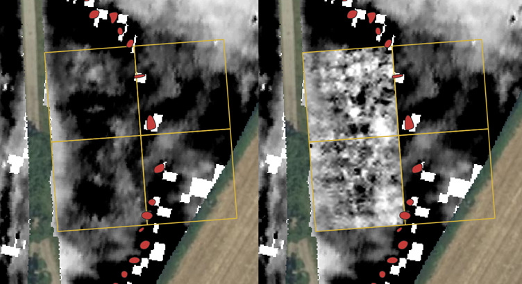
We will do the two grids to the east in October when the dig is on, but instead of a large block of high resistance material in the middle of our grids, we can see it is actually made up of several smaller areas of high resistance. This is likely due to drier ground at the time of our survey. The bands of low resistance show up in the same locations so no major changes there.
Two of the areas of high resistance inside the stone circle interest me in particular, as they look like sockets….To be continued!
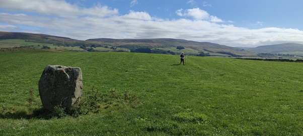
Bonus content: Did we mention we had an absolutely great time at Long Meg? We were joined by Paul Frodsham (AKA Mr Long Meg) who was kind enough to thoroughly induct our team into the mysteries of this amazing place.
Kim showing the young ‘uns the appropriate survey technique…
What’s next?
We are extremely fortunate and extremely excited to be planning to run a community excavation at Long Meg Saturday 22 – Sunday 30 October. There are one or two more spots available to come and join us as this has been very popular and spaces have been snapped up! For more information and to get those last couple of places, please do have a look at the bookings page here.
Most importantly, through the generous funding of Cumbria County Council, we are also inviting young people aged 12+ to join us and learn new skills in archaeology. For more information and how to book, please see here. We can also accommodate group bookings by schools or youth organisations; please email jodie@digventures.com for more information on this.
A huge thank you goes out to the National Lottery Heritage Fund for funding the North Pennines AONB Partnership to deliver the Fellfoot Forward Landscape Partnership Scheme, and to the Cumbria Community Foundation, and Cumbria County Council for their generous funding of the project. An even bigger thank you goes to all the volunteers, staff, students and young people who have been involved so enthusiastically so far. We can’t wait to see you again in October.
Jodie and Kim, part of the DigVentures team
You may also like
Did you know…